River deltas cover about one percent of the Earth's land surface and carry a wildly disproportionate share of its people, food, and trade. They are home to an estimated 350 to 500 million people and to ten of the world's 34 megacities. They grow much of Asia's rice. They anchor ports, fisheries, and the mangroves and flooded forests that buffer coastlines against storms.
They are also, by nature, provisional. A delta exists only because a river keeps delivering sediment to the coast faster than the sea can carry it away. Dam the river's tributaries, mine its sand, pump the groundwater beneath its floodplain, and that balance tips. The land stops building. Then it starts sinking.
A series of studies published over the past two years has begun to measure how far that tipping has already gone — and how much of it is happening below the threshold of everyday notice, at rates of millimeters and centimeters a year that only become visible when a road buckles or a rice crop comes in salty.
Sinking Faster Than the Sea Is Rising
For decades, the conversation about deltas has been a conversation about sea level. The more immediate problem, in most places, is the land. A landmark study published in Nature in January 2026 — Global Subsidence of River Deltas — used satellite radar to measure surface elevation change across 40 deltas on five continents, and found subsidence in every one of them.
More than half are sinking faster than 3 millimeters a year. In 13 — among them the Nile, Po, Chao Phraya, Mekong, Red River, and Yellow River — the average rate exceeds the current global rate of sea-level rise. In the Chao Phraya, Brantas, and Yellow River deltas, the land is going down more than twice as fast as the ocean is coming up. Of the 76 million people living on delta land less than a meter above sea level, 84 percent are in rapidly sinking areas.
Subsidence is largely a local, human-driven process. Unlike global sea-level rise, it can in principle be slowed or halted by decisions taken close to home — yet 26 of the 40 deltas studied combine high relative sea-level rise with low capacity to respond.
Groundwater extraction emerged as the strongest single driver in ten of the 40 deltas, with sediment loss and urban expansion dominating elsewhere. A companion study of Java, published in Science Advances in April 2026, shows what that looks like at close range: along Indonesia's northern coast, subsidence runs between 1 and 15 centimeters a year, and vertical land motion — not the ocean — accounts for the majority of relative sea-level rise along more than three-quarters of the 1,500-kilometer coastline. Where groundwater rules tightened in Jakarta, the sinking slowed. Where extraction shifted to peri-urban and agricultural districts, new subsidence hotspots opened up. The problem was displaced, not solved.
A Delta Is Only as Strong as Its Sediment
Dams trap sediment. Sand mining removes much of what gets through. Between 1990 and 2020, the total annual sediment load delivered to 60 major deltas fell by 15 percent, with declines of more than 20 percent in 26 rivers. The steepest drops were all in Asia: the Pearl, the Liaohe, the Yangtze, and the Red.
What makes this hard to see — and harder to legislate against — is the lag. Research published in Nature Communications in 2025 found that changes in delta land area trail changes in upstream sediment supply by an average of six years globally, and far longer in tide-dominated deltas, where the average approaches a decade and the Yangtze and Columbia deltas run to 21 and 22 years. Increases in sediment register quickly, within about a year. Losses take six.
That asymmetry has a practical consequence. By the time shoreline retreat shows up in the satellite record, the decision that caused it is a decade old and the reservoir is long since built. It also means the full effect of the dams already completed has not yet arrived.
Salt Moving Inland
Lower land, less freshwater pushing seaward, and a higher ocean all point in the same direction: salt travels further up the river, and further into the aquifer beneath it. Modeling of 18 estuaries worldwide under a high-emissions scenario projects that annual salt intrusion length will increase in 89 percent of them by the end of the century, by a median of about 9 percent. Sea-level rise contributes roughly twice as much to that increase as reduced river flow.
Extreme events shift too. Salt intrusion that today counts as a once-in-a-century event is projected to intensify in 83 percent of the estuaries studied, and in many of them a two-year event by 2100 will exceed today's hundred-year benchmark. Underground, an assessment drawing on roughly 480,000 coastal groundwater monitoring wells found that about a third of observed coastal areas already have flat or landward hydraulic gradients — conditions that offer little resistance to seawater moving in. Declining water tables are most pronounced in dry, rural, agricultural settings, exactly where irrigation demand is highest and monitoring is thinnest.
For a delta farmer, none of this arrives as a percentage. It arrives as a canal that can no longer be opened, a rice crop that fails, or a well that turns brackish.
The Mekong Delta
No delta illustrates the compound problem more clearly than the Mekong's. Around 20 million people live in the Vietnamese stretch of it, on land that is almost entirely engineered — dikes, sluice gates, and a dense lattice of canals built to grow three rice crops a year. More than 90 percent of the delta's area is now subsiding, and over half of it is sinking faster than 5 millimeters a year, driven largely by groundwater pumping. Upstream dams withhold much of the sediment that once rebuilt the land, while sand mining removes several times more from the riverbed than the river delivers.
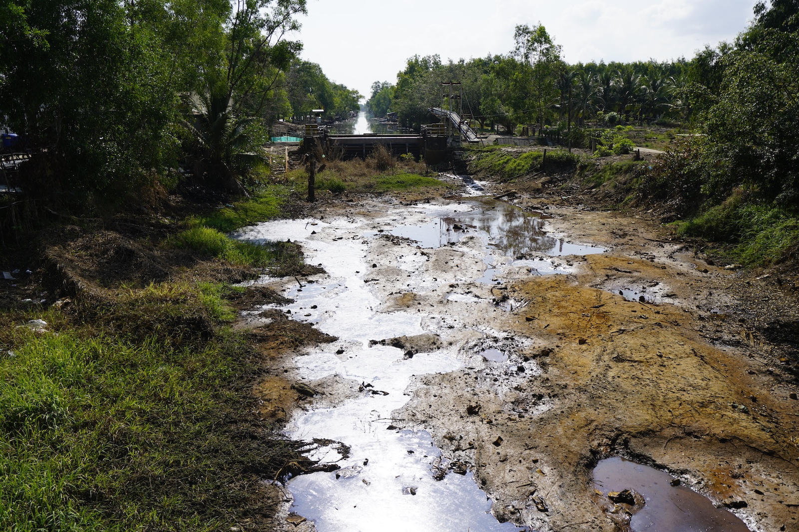
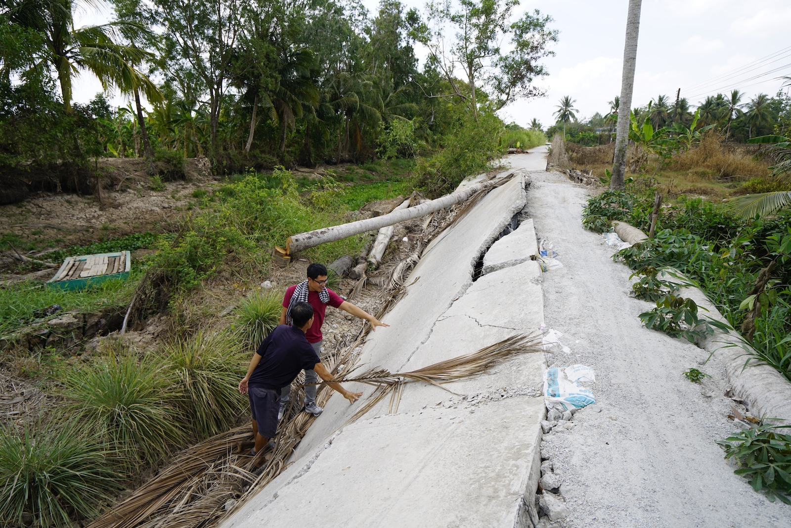
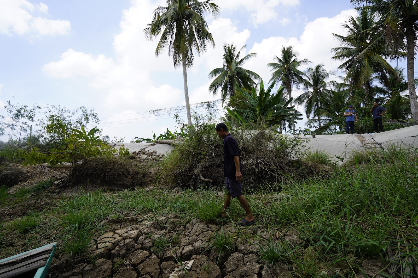
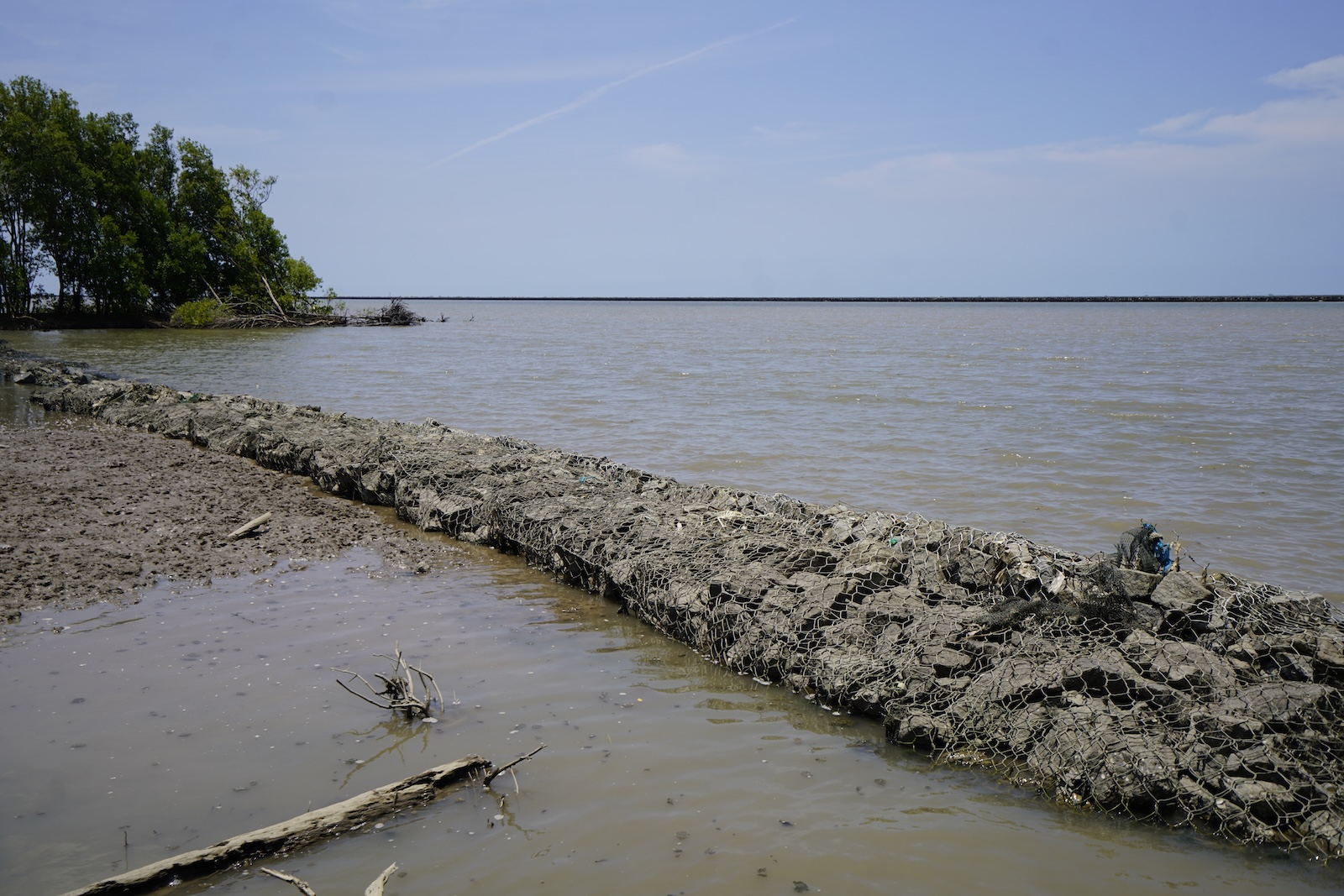
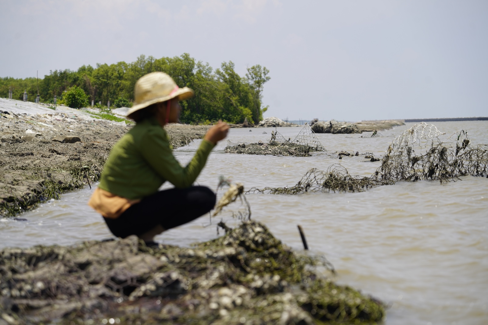
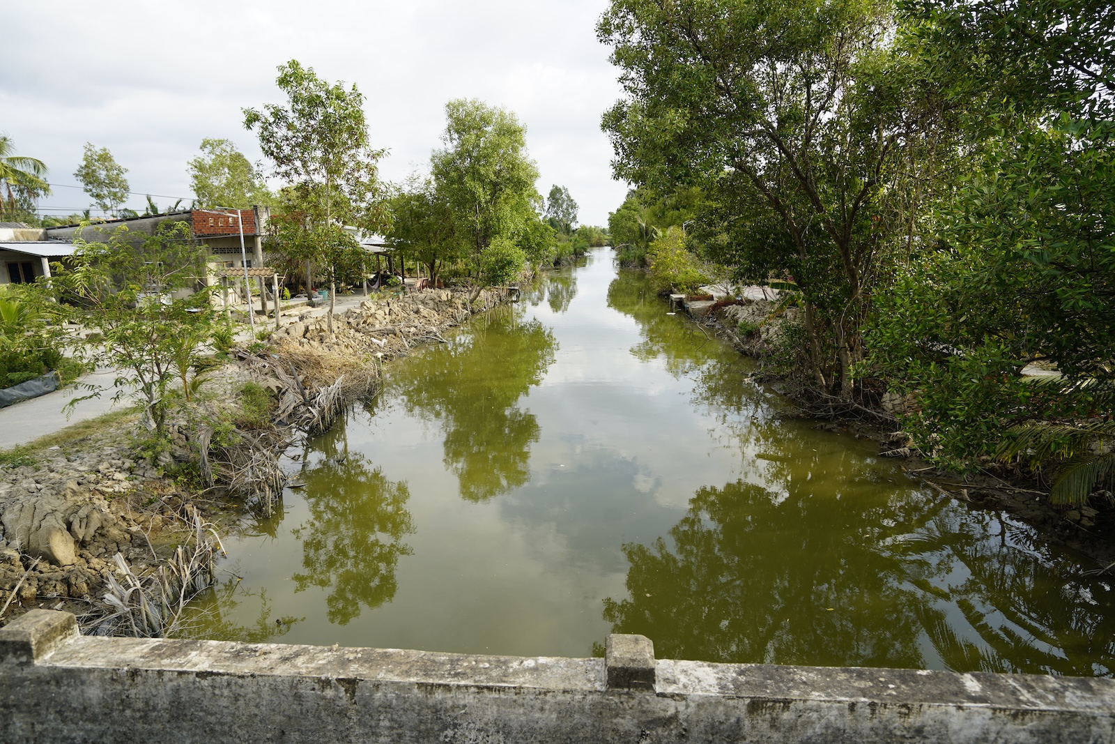
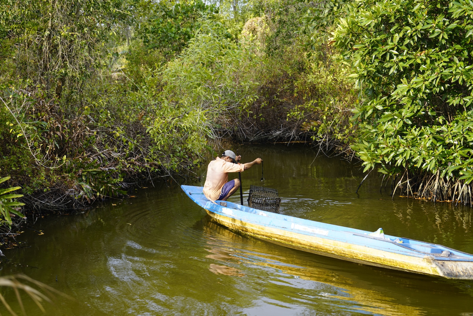
Life in the Mekong Delta, Vietnam. In the dry season, canals shrink to cracked mud behind sluice gates built to hold back saltwater. As the land sinks, roads and embankments split apart and slide into the canals beside them — the most visible everyday evidence of subsidence in the delta. Along the coast, rock-filled barriers and replanted mangroves are used to slow erosion where the shoreline is retreating, while households continue to fish, farm shrimp, and gather oysters in the channels between.
The Vietnamese government has formally shifted its approach, committing under a 2017 resolution to work with the delta's hydrology rather than against it. Projects now underway include retrofitting dikes to let floodwaters back onto farmland, reviving flood-tolerant crops such as lotus and floating rice, and opening sluice gates to restore some seasonal exchange between rivers and floodplains. What no nature-based approach can replace is the sediment itself.
The Last Intact Deltas
Almost nowhere remains to show what an unaltered delta looks like. A 2024 assessment of all 258 river deltas draining into the Mediterranean concluded that no large delta in the basin still qualifies as relatively intact, with the exception of those in Albania. Only about 4 percent of the region's deltas remain in a largely undisturbed state.
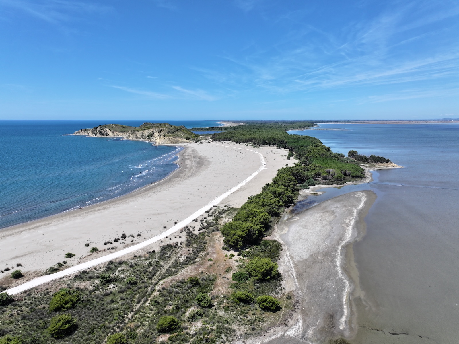
The largest and most biodiverse of them is the Vjosa delta, where Albania's last free-flowing major river meets the Adriatic in a mosaic of lagoons, reed beds, salt flats, and coastal dunes. The Narta Lagoon at its center covers more than 40 square kilometers and hosts over 20,000 wintering waterbirds on the Adriatic Flyway. When the Vjosa became Europe's first Wild River National Park in 2023, the delta was left outside the park boundary under a weaker protection category — a gap that has since become the focus of a national controversy over coastal development.
Published Stories
Mongabay
'Flamingo Revolution' aims to stop Kushner-backed resort on protected Albanian delta
Bulldozers entered the protected Vjosa-Narta delta without permits, clearing coastal pine forest and dunes for a luxury resort development. The response has grown into one of the largest environmental protest movements in Albania's recent history.
June 2026
Yale Environment 360
In a Dammed and Diked Mekong, a Push to Restore the Flow
Facing land subsidence, saltwater intrusion, and flooding tied to decades of engineering, Vietnam has committed to changing how it manages the Mekong Delta — retrofitting dikes and dams to bring back natural flood regimes.
May 2024
National Geographic
Wetlands may be the key to saving the Mekong River
Floodplains, marshes, and mangroves are the least protected part of the Mekong system and among the most important — for fisheries, for flood buffering, and for the tens of millions of people who depend on both.
2024